Dunstable Downs winter walk, Bedfordshire
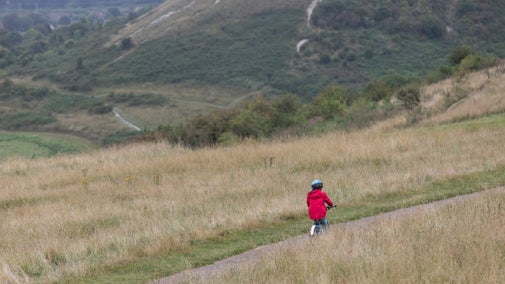
Step outside and enjoy the beautiful Bedfordshire countryside on this exhilarating walk across the Dunstable Downs. Along the way, discover diverse wildlife, Iron Age hill forts; burial mounds and the Ridgeway Link.
While you're here
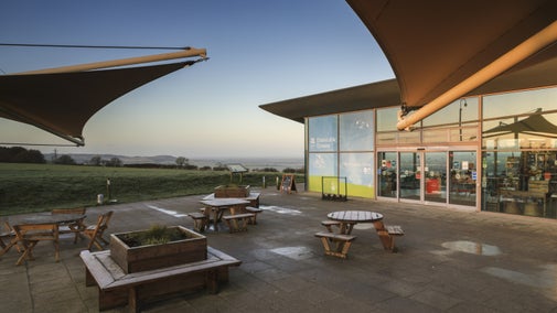
Suitable for active families. Don’t forget to pop into the Chilterns Gateway Centre for some delicious food and a browse around our gift shop.


Start:
Visitor Centre car park, grid ref: TL008195
1
From the car park walk slightly downhill over the grass area, then turn right at the wind catcher following the path along the top of the slope, past the site of the medieval warren, as far as the Five Knolls tumuli.
Five Knolls
Lying on the edge of the Downs, this Scheduled Ancient Monument is the largest round barrow cemetery in Bedfordshire. Visible as bumps against the skyline, the burial mounds were excavated in the 1850s and 1920s, revealing that they originated in the late Neolithic and Bronze Age and re-used for burial in the Roman period.
2
Continue downhill to West Street, which runs along the line of the Icknield Way.
3
Cross West Street on to Green Lane opposite, known also as Drovers' Way.
Drovers' Way
Green Lane at point 3 on the map is part of a network of tracks and paths in and around Dunstable. Traditionally used by drovers to take livestock to market in Dunstable, it's now popular with walkers and horse riders.
4
Continue as far as the crossroads. In the field diagonally to the right, the line of trees mark the rampart of Maiden Bower, an Iron Age hill fort. At the second crossroads, turn left along the Houghton Green Highway into Totternhoe village.
Maiden Bower
Maiden Bower is situated about 1km to the north east of Totternhoe, on a broad plateau below the Dunstable Downs which overlooks the northern edge of the Chiltern scarp. The monument includes a large univallate hillfort of Iron Age date, although surface finds, small scale excavation and recent geophysical surveys have also demonstrated the existence of a Neolithic causewayed enclosure in this location, and provided evidence of Romano-British activity within the ramparts.

5
Cross Dunstable Road and follow Furlong Lane, turn left onto Church Road and left again on to Well Head Road. Follow this as far as the Icknield Way near Well Head.
Icknield Way
The Icknield Way is unique among long distance tracks because it can claim to be "the oldest road in Britain". Extending from Ivinghoe Beacon in Buckinghamshire to Knettishall Heath in Norfolk, it is 110 miles (177 kms) in length, and consists of prehistoric pathways, ancient when the Romans came.

6
Cross the road and follow the bridleway opposite as far as the base of the Downs.
7
Turn right at the end of the bridleway. Follow the footpath at the bottom of the slope, through the fence, until a track is reached on the left. NOTE: for a shorter walk, follow this track uphill and back to the starting point along an ancient hollow way.
8
Pass through a gate, turn left uphill for 49yd (45m), then turn right onto a sunken way. This path is an old cut way, which would have offered travellers an easier way up the slope. Follow this path as it climbs up the Downs and then back to the bottom.
9
Join the footpath that follows the bottom of the Downs.
10
Just before the road, join the bridleway which climbs uphill, looking back views of the Vale of Aylesbury and Ivinghoe Beacon appear.
The Vale of Aylesbury and Ivinghoe Beacon
The Aylesbury Vale (or Vale of Aylesbury) is a large area of gently rolling agricultural landscape located in the northern half of Buckinghamshire, England. Its boundary is marked by Milton Keynes to the north, Leighton Buzzard and the Chiltern Hills to the east and south, Thame to the south and Bicester and Brackley to the west. The bed being largely made up of clay that was formed at the end of the ice age. Ivinghoe Beacon is a prominent hill and landmark in the Chiltern Hills, and stands 233 m (757 ft) above sea level.

11
With the car park on your right, carry on uphill and turn left into a large grass field. Please keep your dogs on a lead in this field as there may be sheep grazing.
12
Follow the hedge line at the top of the field, with more views of the Vale of Aylesbury on your left. You're following the Ridgeway Link a linear walking route linking two spectacular landmarks in the Chilterns landscape, the Chilterns Gateway Centre and Ivinghoe Beacon. After walking under a number of Beech trees and passing through a bridlegate, the Chilterns Gateway Centre soon appears on the right.
Chilterns Gateway Centre
After an invigorating walk along the Dunstable Downs, take a well-deserved break at the Chilterns Gateway Centre café. Tuck into one of our local specialities, such as the famous Bedfordshire Clanger, or our tasty bacon roll.
End:
Visitor Centre car park, grid ref: TL008195