
Become a member
Join today and help protect nature, beauty and history – for everyone, for ever. Enjoy access to more than 500 places with National Trust membership.
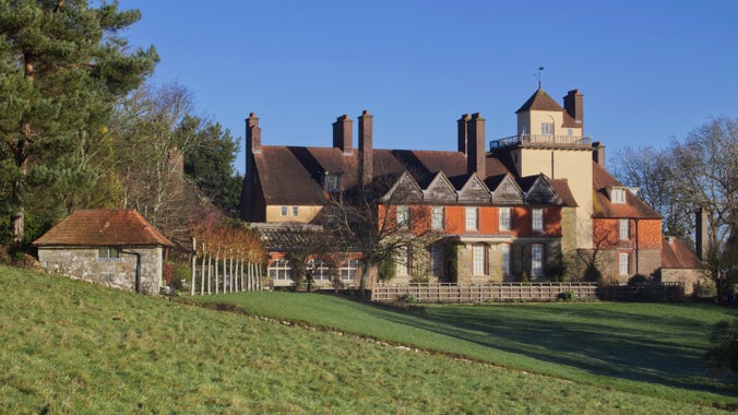
Arts and Crafts family home with Morris & Co. interiors, set in a beautiful hillside garden
West Hoathly Road, East Grinstead, West Sussex, RH19 4NE
| M | T | W | T | F | S | S |
|---|---|---|---|---|---|---|
Open
Closed
| Asset | Opening time |
|---|---|
| House | 11:00 - 15:30 |
| Café | 10:00 - 16:00 |
| Garden | 10:00 - 16:00 |
| Shop | 11:00 - 16:00 |
| Secondhand bookshop | 11:00 - 15:00 |
House & shop closed every Mon and Tues 5 Jan - 10 Feb inclusive. House open by tour Weds, Thurs & Fri 14 Jan - 13 Feb inclusive. Tour times are: 11am, 11.30am, 12.15pm, 12.45pm, 1.15pm & 2.30pm. House open every weekend, 11am - 3.30pm. From 14 Feb the house will reopen daily. Last entry to the house is 30 minutes before we close. Last orders in the cafe are at 3.30pm.
| Ticket type | With Gift Aid | Without Gift Aid |
|---|---|---|
| Adult (18+) | £18.70 | £17.00 |
| Child (5-17) under 5s free | £9.80 | £8.50 |
| Family (2 Adults and up to 3 children) | £46.80 | £42.50 |
| 1 adult, up to 3 children | £28.10 | £25.50 |
| Group (Adult 18+) | £16.15 | |
| Group (Child 5-17) | £8.08 |
| Ticket type | With Gift Aid | Without Gift Aid |
|---|---|---|
| Adult (18+) | £19.80 | £18.00 |
| Child (5-17) under 5s free | £9.90 | £9.00 |
| Family (2 Adults and up to 3 children) | £49.50 | £45.00 |
| 1 adult and up to 3 children | £29.70 | £27.00 |
| Group (Adult 18+) | £17.10 | |
| Group (Child 5-17) | £8.55 |
Second-hand bookshop open 10am - 5pm.
Lunches, snacks and freshly made cakes using produce from our Kitchen Garden when in season.
Open 10am - 5pm.
Well behaved dogs on short leads are welcome.
Arts & Crafts and Morris & Co. inspired gifts, textiles and ceramics.
Mobility parking near entrance. Partly accessible grounds with slopes and steps. Adapted toilets.
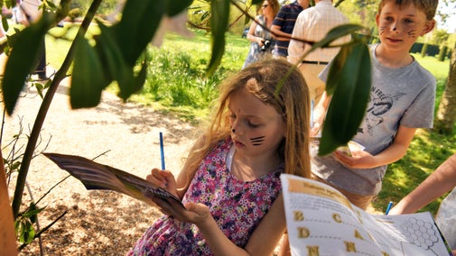
Find family-friendly things to do at Standen, from activity based trails in the school holidays and walking woodland paths to building a den and running off steam in Adventure Corner. Download a copy of our family map to plan ahead with your family visit.

Stay up to date with all our events here at Standen and plan your visit before you arrive. From children's trails in the school holidays and music on a Sunday afternoon, to Arts and Crafts exhibitions and demonstrations, find out more about our year round seasonal events.
Bring your dog for a walk at Standen and explore acres of woodland paths. Dogs are also welcome in the formal garden so you can explore more with your four-legged friend. Standen House and Garden is a two pawprint rated place.

Sometimes it's the little things that make the best family memories, like having a swing, playing in the grass or spotting bugs on a family walk. Our new family maps are free to pick up and show how to best enjoy your family visit.
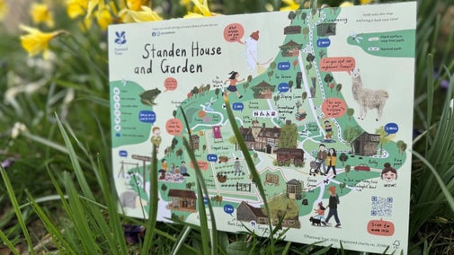
Plan your visit to this Arts and Crafts house and garden.

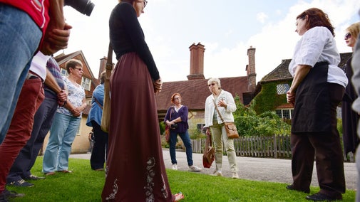
Standen is a great place to visit with a group. For a day to remember, book a Standen history tour with one of our friendly guides, then stop off for lunch or refreshments in the barn cafe. Visit the Arts and Crafts house, walk around the hillside garden or explore further afield in the woodland. Browse the range of William Morris products in the shop and find a gift for a special someone, or even just treat yourself. Group discounts are available. To chat through your group visit please email standengroups@nationaltrust.org.uk or call 01342 323029.
One of the finest examples of Arts and Crafts workmanship, with Morris & Co. interiors.
Hillside garden for all seasons, with an award-winning plant collection and views across the Sussex countryside. Features an orchard, kitchen garden and rosery.
Footpaths from the estate lead to High Weald woodland and Ashdown Forest.
Our natural play area has reopened and features a willow maze, wooden swing and balance beam for children to enjoy.
Converted 18th-century barn, serving seasonal lunches and homemade cakes, some made with produce from the kitchen garden.
Arts and Crafts and Morris & Co. inspired gifts, textiles and ceramics with a range of seasonal plants and pots to fill your garden.
Second-hand bookshop with a variety of books on offer, from fiction to fantasy.
Find family-friendly things to do at Standen, from activity based trails in the school holidays and walking woodland paths to building a den and running off steam in Adventure Corner. Download a copy of our family map to plan ahead with your family visit.

Explore the family home of the Beales, designed by Philip Webb and furnished throughout by Morris & Co fabrics and wallpapers. An Arts and Crafts inspired comfortable country retreat.
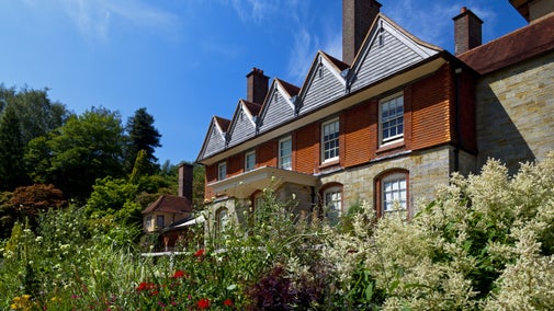
Stroll around the Arts and Crafts inspired hillside garden at Standen, explore themed outdoor rooms and find a rare collection of plants including ones grown by Margaret Beale. Please note that access to the upper gardens is via the bookshop steps and the Quarry Garden is closed.

Enjoy self-guided walks through 100 acres of West Sussex countryside on the Standen estate, including ancient woodlands, wildflower meadows and links to the Bluebell Steam Railway.

A moderate three-mile walk that takes in the whole Standen estate and wider countryside.

Treat yourself to a seasonal meal or snack from the Barn Café at Standen House and Garden.

Take a piece of Standen home with you when you visit our shop in the old Scullery.

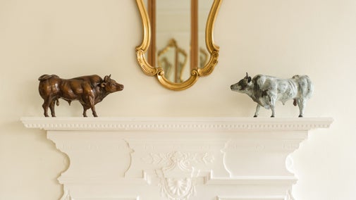
Sat 28 Feb - Sun 29 Mar, daily but closed on Mondays. 11am - 3.30pm. An exhibition of limited edition sculptured bronze birds and animals by Diana Pattenden. Known for her highly observed and detailed bronze animals, Diana's sculptures distil the essence of a range of emotions.
Join Ben and his friends on this family friendly trail around the garden at Standen. Ben loves flowers and butterflies, so when his friends Worm and Ladybird suggest he makes his garden prettier by growing his own butterfly garden, he soon sets to work. This trail follows the story of the same name by Kate Petty and Axel Scheffler. In collaboration with Nosy Crow. The book is available in our shop.

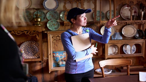
Weds 14 Jan - Fri 13 Feb: half hourly between 11am and 2.30pm. Take a taster tour of the house while it's closed for winter conservation. Join one of our knowledgeable volunteer house guides as they show you around in small groups and share their knowledge of the house, its fabulous William Morris interiors, and stories of the Beale family who made Standen their home in the country. Booking not needed. Tickets available on arrival from reception. Free tours, admission applies.
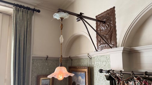
This new exhibition tells the story of Standen as one of the first country houses to be designed with electricity. At the time Standen was built, this technology was innovative and new, yet it was also seen as dangerous and potentially harmful. This exhibition explores the social context of electricity and its use in the Victorian period through cartoons and illustrations from Punch magazine, alongside examples of some of Standen's collection of light fittings by Arts and Crafts designer W.A.S.Benson. See the exhibition in the Servants Hall between Weds 14 Jan & Sun 21 Jun. 11am – 3pm. (4pm in the summer months).
This spring, treat the whole family to a world of adventure at Standen on an Easter trail.Make your way along the trail and find activities for the whole family. The trail takes place between Sat 14 Mar & Sun 12 Apr 2026, between 10am - 4.30pm, with last entry at 4pm, so come along and explore the beautiful garden at Standen. Prices are £3.50 per trail which includes an Easter trail sheet, bunny ears and dairy or vegan and Free From* chocolate egg. *Suitable for people with milk, egg, gluten, peanut and tree nut allergies. At Standen Easter adventures include a family trail with activities such as hook a duck, skittles and opportunities to take plenty of selfies with Easter decorations. In the house spot the hidden Easter eggs. Normal Admission Charges Apply

As part of the Morris Month celebrations at The William Morris Society, our archive team will be on hand to share original documents and insights around the Morris & Co furniture and fittings which decorate the house at Standen. Standen has a wonderful selection of archive material from photographs taken by the family as well as Margaret Beale's decorating notes and original bills from Morris & Co. This is a rare opportunity to talk to our knowledgeable archive volunteers and explore original documents not usually on display to the public. Normal admission applies. About Morris Month:- We’re celebrating Morris Month this March with the William Morris Society and leading cultural collaborators. Join events and workshops that show how the legacy of William and May Morris continues to shape creativity, craft and culture today. Read more about Morris Month by visiting the William Morris Society website.

An 8.5-mile walk for more experienced walkers, from Standen to Selsfield Common and back, that takes in woodland, heathland and open-country paths.

Walk to and from Kingscote Station and Bluebell Railway, where connecting steam trains can be taken to Sheffield Park or into the historic town of East Grinstead.

A short walk around Standen's Hollybush Wood, a haven for ancient woodland indicator plants.

Experience how it felt to live in an Arts and Crafts house and stay The Morris Apartment, a one-bedroom apartment in trademark Arts and Crafts style on the second floor of Standen House. After all the visitors have left, explore the gardens at Standen at your leisure.

A one-bedroom apartment in trademark Arts and Crafts style, on the second floor of Standen House.
Sat 7 Feb - Sun 8 Mar: 10am - 3.30pm. Join Ben & friends on a family trail round the garden. Normal admission applies. Free trail.
It's snowdrop season at Standen, bringing a hint of spring to the garden and woodland. Fri 30 Jan - Sat 28 Feb: 10am - 4pm.
This new exhibition tells the story of Standen as one of the first country houses to be designed with electricity. See the exhibition in the Servants Hall between Weds 14 Jan & Sun 21 Jun. 11am – 3pm. (4pm in summer).
Weds 14 Jan - Fri 13 Feb: between 11am & 2.30pm. Take a taster tour of the house while it's closed for winter conservation. Free tours, normal admission applies. Tickets available on arrival from reception on a first come, first served basis.
Tues 17, Weds 18, Fri 20 & Sun 22 Feb: 11am - 12pm & 1pm - 2pm. Have fun making your very own paper flowerpot and join Ben and his friends on this family-friendly trail.
An exhibition of limited edition bronze birds and animals by Diana Pattenden.
As part of the Morris Month celebrations, our archive team will be on hand to share original documents and insights around the Morris & Co furniture and fittings which decorate the house at Standen. Sat 8 & Sun 9 Mar: 11am - 3pm. Normal admission.
This spring, treat the whole family to a world of adventure at Standen on an Easter trail.
James and Margaret Beale chose an idyllic location with views across the Sussex countryside for their rural retreat. Designed by Philip Webb, the house is one of the finest examples of Arts and Crafts workmanship, with Morris & Co. interiors creating a warm and welcoming atmosphere. The house is dressed for a weekend stay in 1925, so you can imagine you are a guest of the family.
A major restoration of the 5-hectare (12-acre) hillside garden showcases year-round seasonal highlights and an award-winning plant collection. On the wider estate, footpaths lead out into the woodlands, Ashdown Forest and wider High Weald Area of Outstanding Natural Beauty.
Note: Well behaved dogs on short leads are welcome in the formal gardens.
Find out more about this modern home with historic influences and charming Arts and Crafts workmanship, designed and built for the Beale family at Standen in West Sussex.

Helen Beale was the youngest daughter of James and Margaret Beale. She was independent and self assured, and was involved in nursing, the WRNS and the First World War.

Discover the Beale family, who commissioned Standen to be designed and built by architect Philip Webb .

Standen was designed in 1891 by Philip Webb for Margaret and James Beale and their family, who lived there until 1972 when the house was given to the National Trust. For the first decade of our ownership, the collection was expanded by Helen and Arthur Grogan who lived in the house and opened it to the public. The collection reflects the creativity and taste of all these people, and features items designed by leading late 19th century artists and craftspeople.
There are several original Morris & Co wallpapers in the house. Philip Webb worked closely with William Morris and recommended the firm’s papers as suitable decoration. ‘Trellis’ was among the first wallpaper patterns to be produced by Morris & Co and was used in the downstairs corridors at Standen. The design reflects the trellis installed by Webb on the south terrace, uniting house and garden.

The decoration of Standen and the planting of the garden reflect the taste, creativity and energy of Margaret Beale. She embroidered some of the textiles herself, and is shown in this portrait busy with her crochet. By contrast, in the companion portrait painted to mark his retirement, her husband James is depicted with his hands folded in inactivity.

The chest of drawers, dressing table, mirror, bedside table and clothes press in the Larkspur Room were designed by Ernest Gimson, one of the most influential designers of English Arts and Crafts furniture. The matching pieces are made from figured mahogany and have fine detailing, including chequered beading and silvered metal handles.

Explore all the objects and works of art we care for at Standen on the National Trust Collections website.

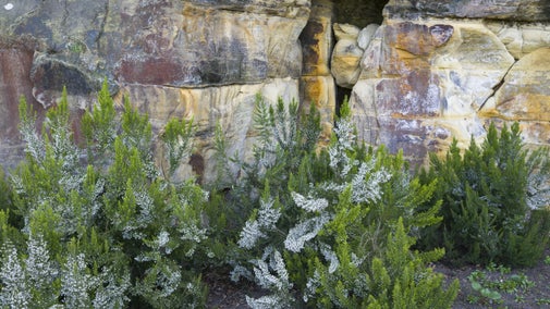
Created in Victorian times, the Quarry Garden at Standen is in need of urgent restoration. Shoring up and rebuilding are planned in the coming years before it can be replanted and reopened. Once a main feature of the garden with a small pond used by the Beale children to sail their toy boats, it's historic drainage system has failed and it's fallen victim to a changing climate with more frequent bouts of intense rainfall which have led to its partial collapse.
We’re installing a pellet biomass system to provide heating and hot water to the house & three apartments, plus two Air-Source Heat Pump systems to cater for Standen Cottage.

Find out about the conservation work that goes into looking after Standen, including major projects, which have restored areas as they would have been when the Beales lived here.
Volunteers are essential to the work we do at Standen. Varied roles include greeting visitors, working front of house in the café or keeping the garden looking its best. If you'd like to talk to us about volunteering, please call 01342 323029 or email us at standen@nationaltrust.org.uk

National Trust supporter groups across Sussex help to raise funds for places like Nymans and Sheffield Park, while also getting together for days out, talks and volunteering.


Join today and help protect nature, beauty and history – for everyone, for ever. Enjoy access to more than 500 places with National Trust membership.
By sharing your email address you’re agreeing to receive marketing emails from the National Trust and confirm you’re 18 years old or over. Please see our for more information on how we look after your personal data.